Our online forms are working again

Our online forms, MySouthwark accounts and services.southwark.gov.uk webpages are now working. If you are still seeing an error message, please clear your cookies and cache.

Newington Pocket Parks

Design sketches and visualisations 

1. Amelia Street
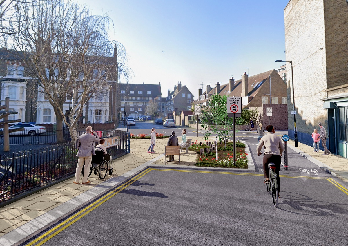
Amelia Street Pocket Park
The junction of Amelia Street with Penton Place. There is a two lane cycle path connecting the two roads, which runs alongside a planted area with trees, flowering plants and two seats. There are double yellow lines along the edges of Amelia Street. 
Amelia Street Pocket Park map
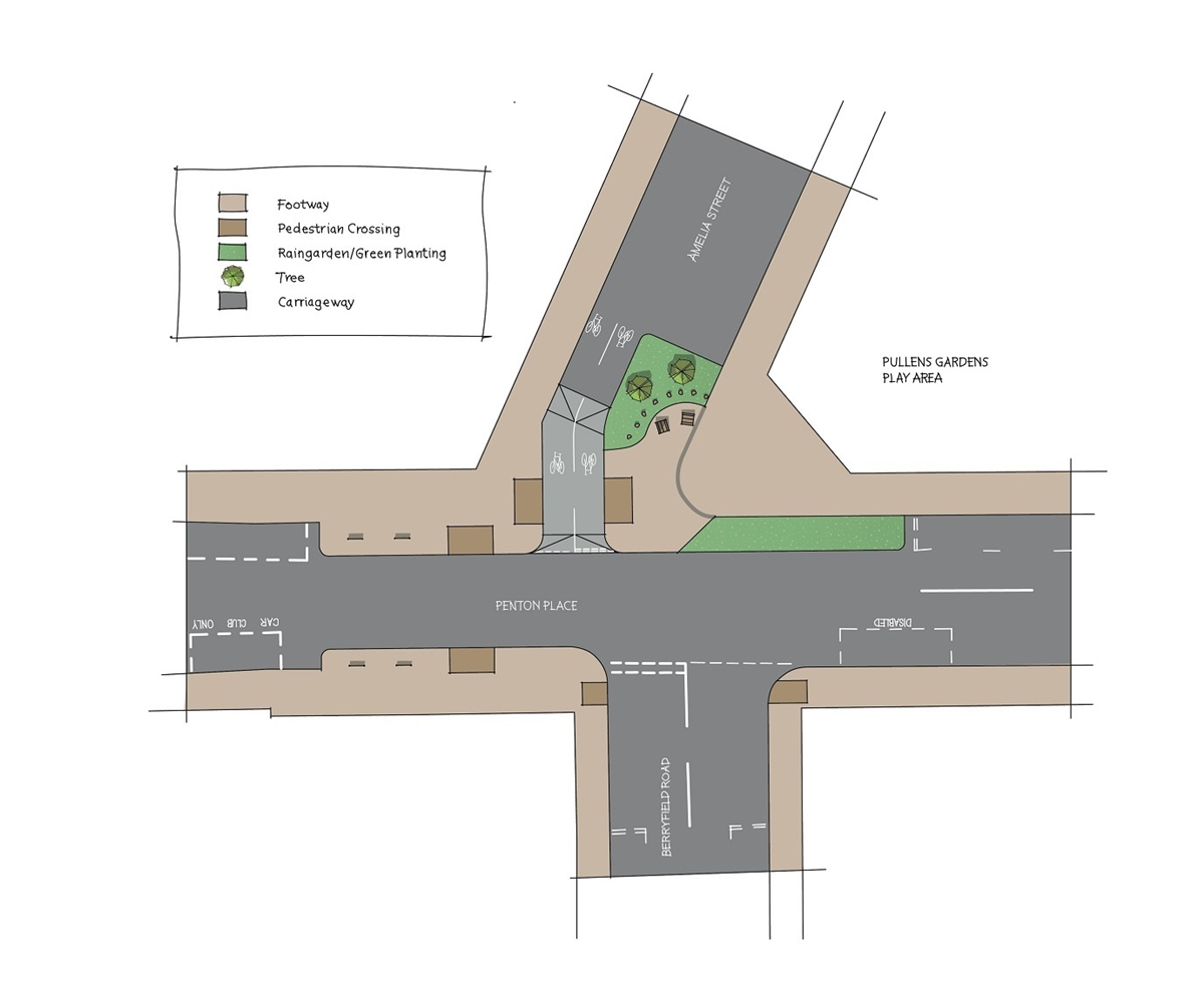
A plan of the junction of Amelia Street, Penton Place and Berryfield Road, showing footways, pedestrian crossings. Parking bays for a car club user and a disabled driver. There are two planted areas at the junction of Amelia Street and Penton Place.

2. Alberta Street junction with Ambergate Street
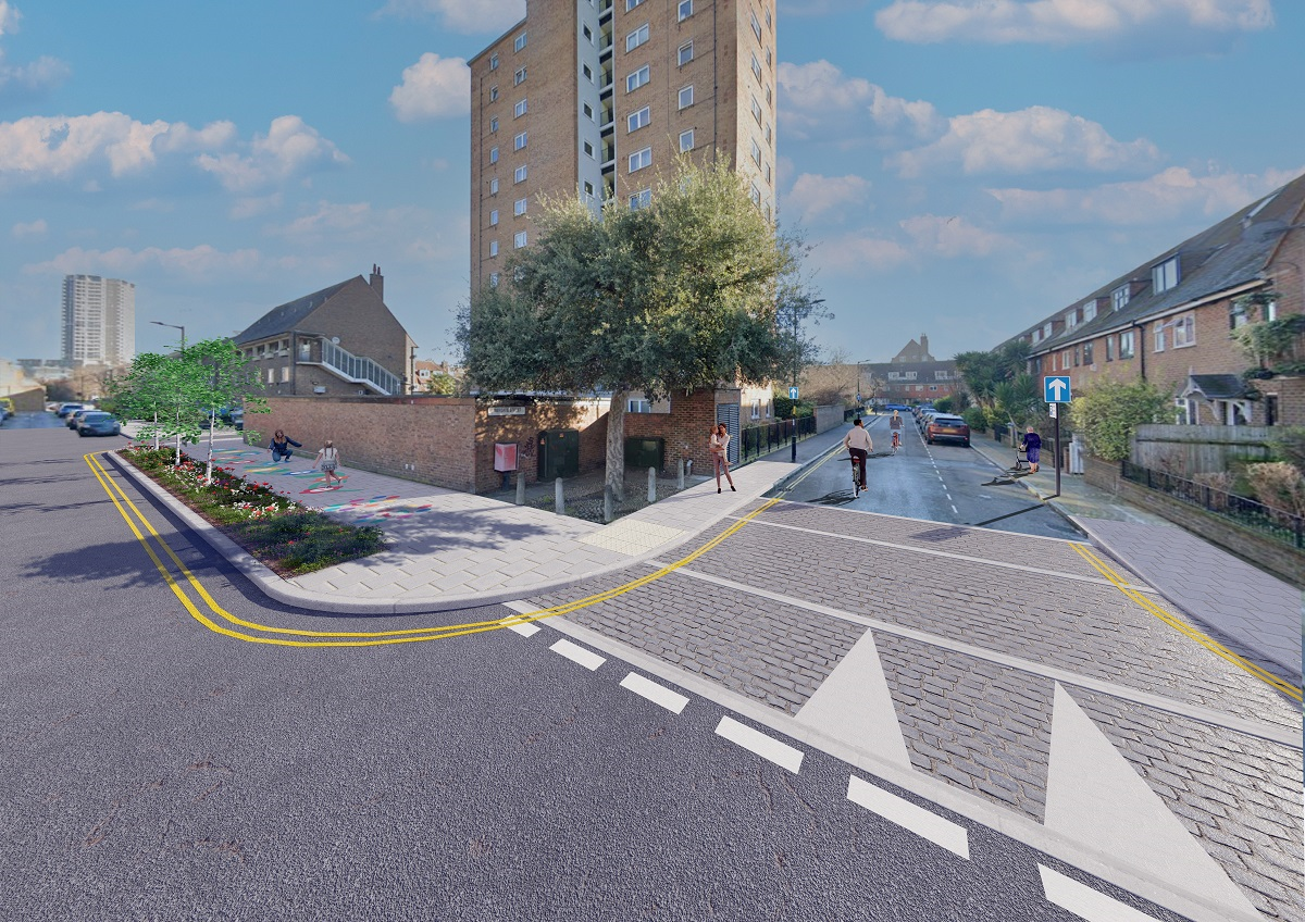
Aleberta Street Pocket Park
The junction of Alberta Street  with Ambergate Street. There is a planted area with trees and flowering plants, and a decorated section of footway where children are playing. 
Alberta Street Pocket Park map
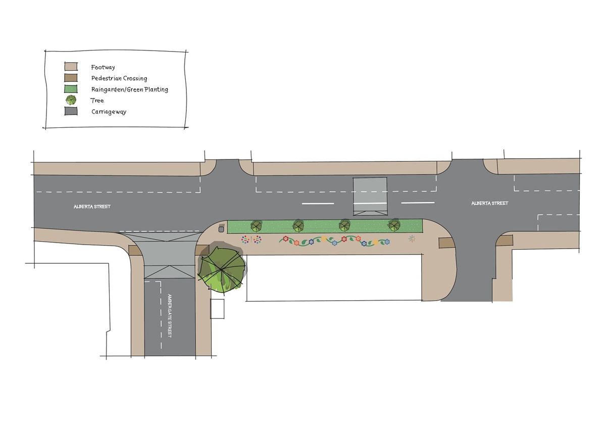
A plan of the junction of Alberta Street with Ambergate Street, showing planted areas, trees, pedestrian corssings and a footway decorated with shapes for interactive play.

3. Chapter Road

Chapter Road Pocket Park
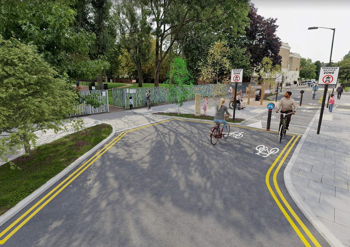
Chapter Road near the entrance to Pasley Park. There is a two lane cycle path connecting two sections of the road. This runs alongside a planted area with trees, plants and interactive play features.
Chapter Road Pocket Park map
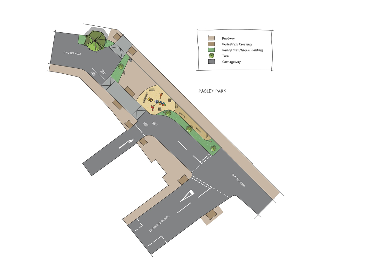
A plan of Chapter Road near the entrance to Pasley Park including the junction with Lorrimore Square. It shows a two lane cycle path connecting two sections of the road and a planted area with trees, plants and interactive play features.

4. Alberta Street and Braganza Street
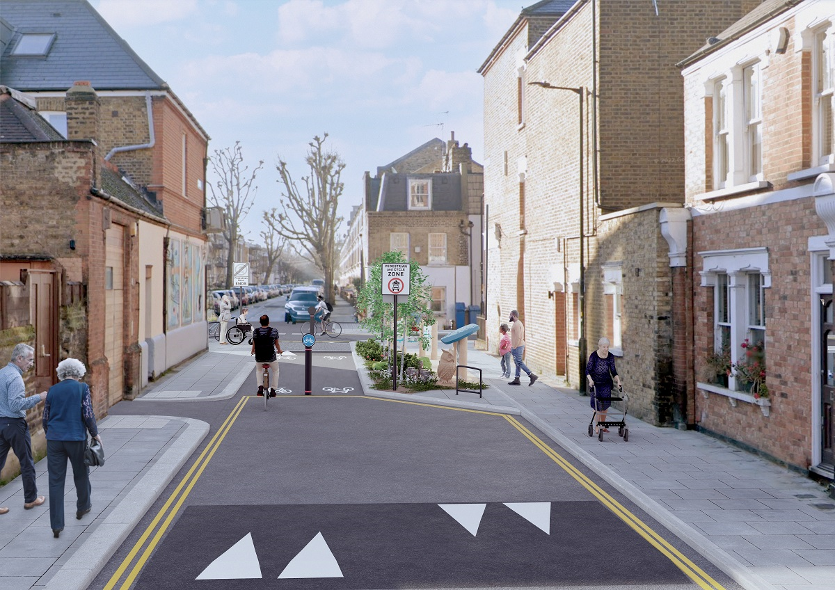
Alberta Street and Braganza Street Pocket Park
Alberta Street at the junction with Braganza Street. There is a two lane cycle path connecting the two roads, which runs alongside a planted area with trees, flowering plants and sculptures. There are double yellow lines along the edges of Alberta Street.
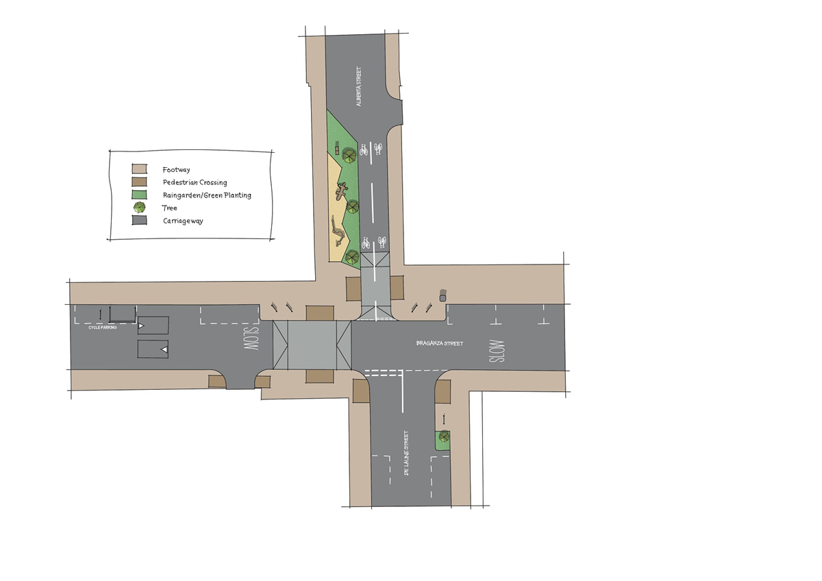
Alberta Street and Braganza Street Pocket Park map
Plan of the junctions of Alberta Street with Braganza Street and De Laune Street. It shows a two lane cycle path, a planted area, pedestrian crossings and cycle parking.


Page last updated: 16 July 2024

}

Privacy settings